Sources of Geographic and Cartographic Information
Recording date: Mar 18, 2025
Viewed: 0
time
This course introduces cartography and Geographic Information
Systems (GIS) specifically for studying coastal sedimentary
environments. It covers key vector and raster data methods, reference
systems, and types of geographic data. Students will learn to create
thematic maps, process vector data, and apply GIS to real-world
coastal management challenges. Additional topics include remote
sensing, Copernicus data, georeferencing, land cover classification,
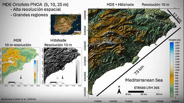
and digital elevation models (DEMs) for analyzing coastal morphology
and sediment patterns. Practical skills in data collection, coastal
resource management, and GPS tracking equip students to analyze
and manage sediment dynamics in coastal ecosystems.
-
: Daniel Cajade PascualPhD in Geography from the University of Santiago de Compostela
-
: Ángela Fontán BouzasInvestigadora, Universidade de Vigo
-
Postproduction: Mr. Paco BrisaboaAudiovisual technician, TELTEK Video Research S.L.
-
Publisher: Mr. Paco BrisaboaAudiovisual technician, TELTEK Video Research S.L.

